City History
Frostburg is located in the western portion of present Allegany County, formerly in the center of old Allegany County as created in 1789, until Garrett County was created in 1873, leaving the City within 2 miles of the western Allegany County line along Big Savage Mountain, dividing the two westernmost counties in Maryland.
The original Frost Town was situated along a ridge that runs perpendicular to Big Savage Mountain. This ridge provides the high ground serving as a division point for head waters of four drainages: George’s Creek to the south; its tributary Sand Spring Run to the west; Jennings Run to the north; and Braddock Run to the east. Sand Spring Run flows to a confluence with George’s Creek, which becomes a direct tributary of the North Branch of the Potomac River, while Jennings Run and Braddock Run flow into Wills Creek near the Narrows before reaching the Potomac at Cumberland.
Although Braddock’s Road, the French and Indian War military road constructed for the British and Colonial effort against the French at the Forks of the Ohio, passed through the south end of the future City, settlement of and the place name for the region referred to as Mount Pleasant came 65 years later in direct response to planning for the National Road, the nation’s first Federally funded roadway, authorized by Congress in 1806. The roadway from the Chesapeake region to the Ohio Country began construction in Cumberland in 1811 and opened through Frostburg in the founding year of 1812.
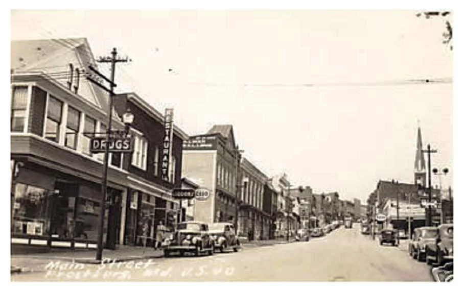
Frostburg began as a land speculation by the early settler Frost family, specifically laid out by Meshach and Catherine Majers Frost. Mr. Frost, son of Josiah, an early settler west of Cumberland, was one of a few large landowners in the region at the time a specific route was disclosed for the National Road. The Stockton Stagecoach Company began operations on the ridge in 1818. In 1819 Meshach Frost, then patriarch of the Frost family, rented a Frost-constructed building to Stockton that operated as a tavern and inn and was known as Highland Hall. The National Road carried farm produce and raw materials to the eastern markets from the Frostburg area as the road progressed west towards Wheeling on the Ohio River, reached in 1818. Postal service began in 1820 at the Frost development known informally as Mount Pleasant, and the US Postal Service identified the community officially as Frostburg at that time, although for many years maps showed “Frost Town.” Incorporation finally came in 1878.
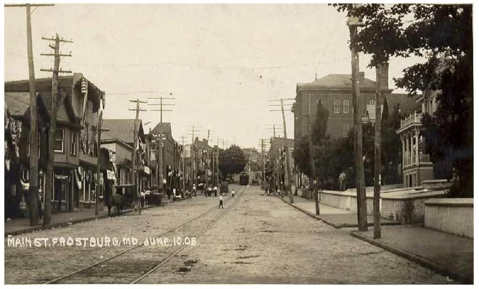
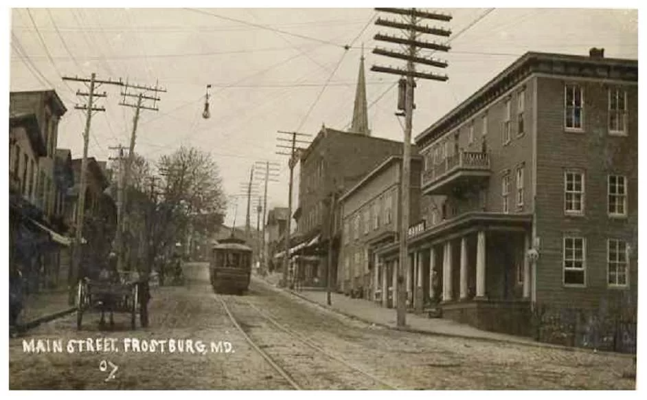
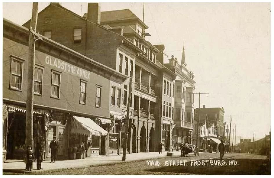
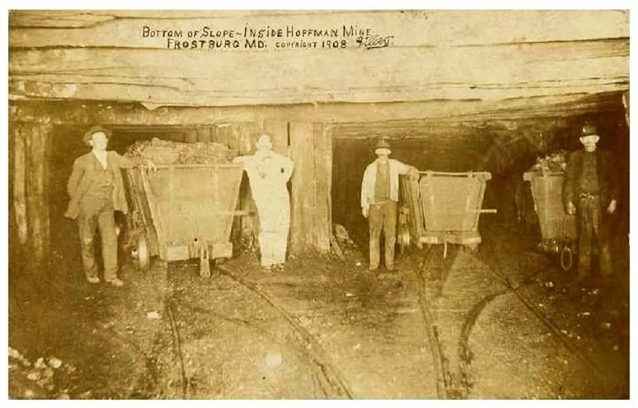
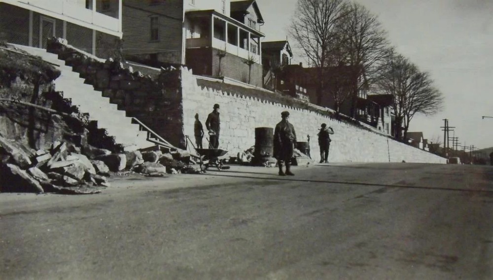
While the roadway continued to be a major travel corridor west for passengers, raw materials began to shift to the Chesapeake and Ohio Canal (completed in 1850 to Cumberland) and competing railroads Baltimore and Ohio Railroad which reached Cumberland in 1842. Following completion of the B&O to the Ohio River in 1852, a major slump in National Road commercial travel occurred, and Highland Hall was sold to the Catholic Church’s St. Michael Parish for a new church and rectory, beginning an important complex in downtown Frostburg reflecting a more settled community. Major coal interests at this time facilitated rail service west from Cumberland. Two competing lines were extended into the George’s Creek region where synclinal geology gave relatively easy access to major coal seams, including the Pittsburgh “Big Vein” seam. Frostburg was well positioned - at the intersection of the axis of coal reserves and the National Road - to serve as a center for mining activity throughout the rest of the 19th century and well into the 20th century. In 1845 Meshach and his son Josiah Frost began a successful local coal mining company. In 1864 fire clay deposits located on Big Savage Mountain north of Frostburg, lead to the construction of two refractories in the nearby communities of Zihlman and Mt. Savage, providing bricks for the local construction trades and export. By the early 20th century, the City had two railroad stations, reflecting the older local railroad operated by mining interests (the Cumberland and Pennsylvania or C&P Railroad), providing regional passenger and commercial connections; and a competing line to the B&O, the Western Maryland Railway (WMRY), providing interstate connections for goods and passengers to and from the Pittsburgh region. The C&P Railroad tunneled directly through the ridge upon which the National Road rested, crossing from the Jennings Run to the George’s Creek drainage at that point.
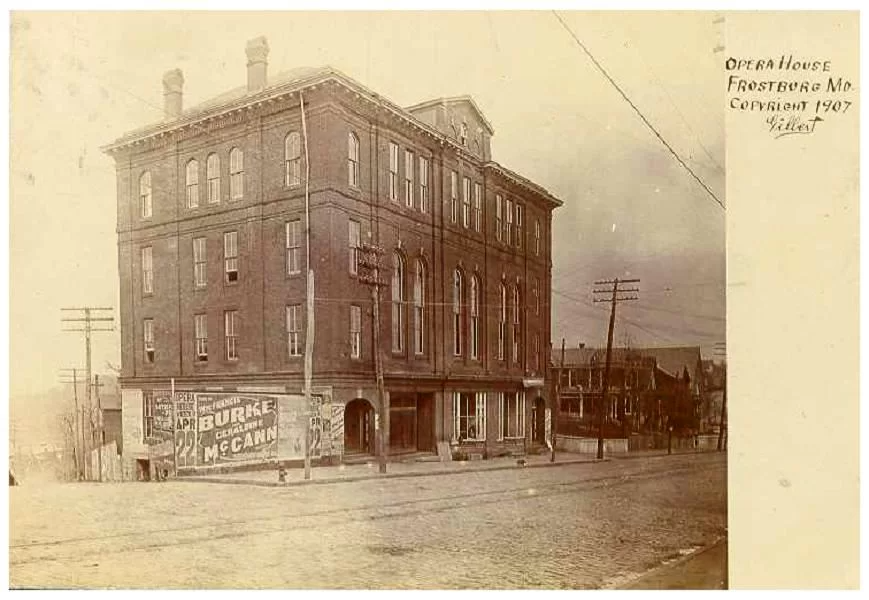
By the early 20th century, 95% of the City’s surface area was situated over deep mining tunnels, although most mine entry points were outside of the City limits. Miner families were interested in education and self-improvement. To this end, in 1898 the community raised funds to purchase parklands to allow the State to appropriate funds for a building to establish Maryland’s second Normal School for teacher training. Old Main, completed in 1900, still exists and is actively used as part of a State University campus containing just over 5,000 students and nearly 900 faculty and staff.
The Normal School was converted to a State Teacher’s College in 1935. After World War II, the Teacher’s College was permitted a 2-year and then a 4-year liberal arts program. From the beginning, Frostburg was an attractive community in which to raise children, and once raised - especially for those interested in becoming public educators - to attend college. In 1963, Frostburg State College came into being. As the State facilitated institutional growth, the State College became the centerpiece of Frostburg’s economy, replacing extraction and transport of raw materials and overshadowing its regional market role and the older traveler-based economy.
During the middle part of the 20th Century, many wage earners commuted to Cumberland-area industrial and commercial jobs. Local retail and service firms were able to thrive to serve both working families and the growing student market. This established the pattern that remains today: a local economy dominated by a combination of goods and services for bedroom community residents, students, and university staff, with a reliance on direct and indirect ‘college town’ jobs. In 1987, the State consented to add Frostburg State University to the State’s university system, driving an expansion to the current level and adding many important academic and administrative buildings.